
Cairns to Cape Tribulation — the reef coast and the Daintree, by car
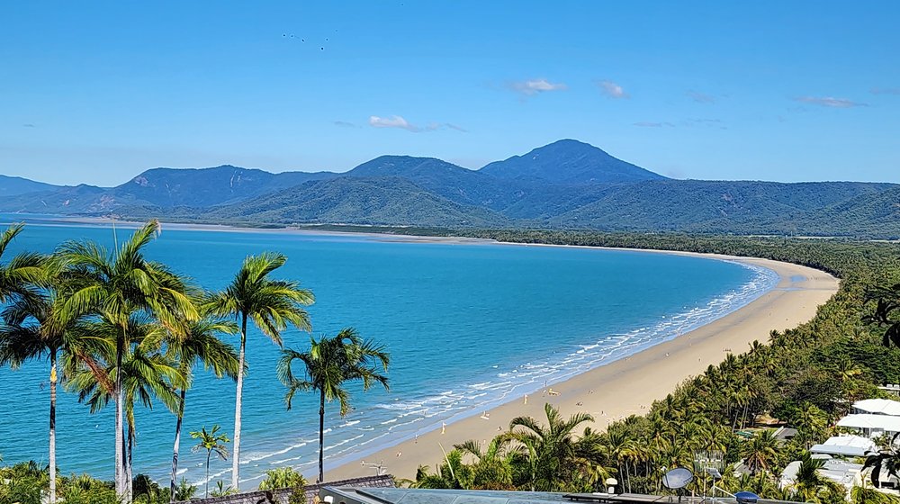
North of Cairns the road runs between the mountains and the Coral Sea. The guide starts on the Esplanade, where the reef boats leave every morning, and follows the Captain Cook Highway past Palm Cove, the crocodiles at Hartley’s and Rex Lookout to Port Douglas and Four Mile Beach.
Past Mossman it walks with you through Mossman Gorge, one stop after another, then crosses the Daintree River on the cable ferry into the rainforest: lookouts, boardwalks through fan palms, the ice cream farm and Cape Tribulation, where the forest meets the reef and the sealed road ends. At every beach it tells you where it is safe to swim.
Every place on the map
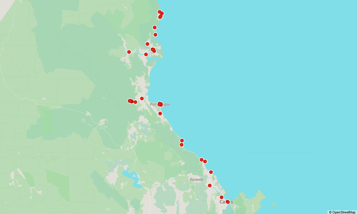
Each red dot is a place with its own story. The story starts by itself when you reach it — on foot, by bike or by car.
All 36 places in this guide
Here is every place the guide tells you about, with the first line of its story:
- Cairns Esplanade and Lagoon — Cairns Esplanade. Long before there was a city, this shore had a name.
- Reef Fleet Terminal - the Great Barrier Reef — Reef Fleet Terminal. At the end of Spence Street, on Trinity Inlet, this is where most of the Cairns reef boats leave in the morning and come back in the late afternoon.
- Cairns Botanic Gardens — Cairns Botanic Gardens, at Edge Hill: one of the finest collections of tropical plants in Australia, and free to enter.
- Skyrail Rainforest Cableway — From this terminal at Smithfield, just five metres above sea level, gondolas climb seven and a half kilometres over the rainforest of the Barron Gorge National Park to the village of Kuranda, up on the range.
- Trinity Beach — One of the quietest of the Cairns northern beaches: a curve of sand, a row of cafés and restaurants along the beachfront, and a lifeguard tower.
- Palm Cove — The resort village of the northern beaches: one beachfront street, Williams Esplanade, with hotels and restaurants facing the sand, the whole length shaded by palms and big old paperbarks.
- Ellis Beach — The last of the Cairns northern beaches, and the point where the Captain Cook Highway comes right down to the sea.
- Hartley's Crocodile Adventures — The story of this place begins with the road.
- Rex Lookout — On a stretch of highway that clings to the hillside, with very few places to pull over, this is one of the very few proper stops: a parking area with a wide view along the coast and out over the Coral Sea.
- Four Mile Beach, Port Douglas — Four Mile Beach. A long, straight sweep of fine pale sand and palms runs south from the headland of Port Douglas, with the rainforest ranges behind it.
- Flagstaff Hill Lookout, Port Douglas — Flagstaff Hill. This is the top of Island Point, the headland Port Douglas grew on.
- Macrossan Street and St Mary's by the Sea — Macrossan Street. The main street of Port Douglas crosses the whole peninsula, from Four Mile Beach on one side to Anzac Park and Dickson Inlet on the other, lined with cafés, restaurants and shops.
- Port Douglas marina - the reef boats — Crystalbrook Superyacht Marina. This is where Port Douglas goes to sea: every morning the reef boats leave these pontoons on Dickson Inlet.
- Wildlife Habitat Port Douglas — Wildlife Habitat. Beside Port Douglas Road, at the edge of town, is a wildlife park built so that you walk among the animals: along raised boardwalks through big open enclosures, with birds flying free around you.
- Mossman and the sugar mill — Mossman. A small sugar town at the foot of the ranges and the administrative centre of Douglas Shire, with about two thousand people and old pubs along Front Street.
- Mossman Gorge Centre — Mossman Gorge Cultural Centre, the gateway to Mossman Gorge and to the country of the Kuku Yalanji, the rainforest people of this coast.
- Mossman Gorge - the Baral Marrjanga boardwalk — Baral Marrjanga. Here at the shuttle stop, with the picnic tables and toilets of the day-use area, the walking begins.
- Mossman Gorge - the river and the swimming spot — Lower River Track. This path leaves the shuttle stop, winds for about three hundred metres along the bank of the Mossman River and then joins the boardwalk.
- Mossman River Lookout — Mossman River Lookout, at the end of the Baral Marrjanga boardwalk.
- Rex Creek suspension bridge — Rex Creek bridge. This suspension bridge hangs over Rex Creek close to where the creek joins the Mossman River, and it sways a little as you cross.
- Manjal Dimbi lookout — Manjal Dimbi. This small lookout, about eighty metres past Rex Creek bridge, faces the mountain that the Mossman Gorge Cultural Centre calls the most prominent of all the mountains around the gorge.
- The strangler fig — This giant began life as a seed left in a bird's dropping in the fork of another tree, high above the dark forest floor.
- The giant mossy boulder — The mossy boulder. This huge rock, granite like the boulders in the river, has grown a green coat in the damp of the forest.
- Wurrmbu Creek — The Rainforest Circuit comes close here to a small creek running down to the Mossman River.
- Daintree Village and the river cruises — Daintree Village. This small town lies about ten kilometres past the ferry turn-off, on the south bank of the Daintree River, so no ferry is needed to reach it.
- Daintree River Ferry — There is no bridge over the Daintree.
- Walu Wugirriga Lookout — Walu Wugirriga, the Mount Alexandra lookout. Walu Wugirriga is the Eastern Kuku Yalanji name, and the lookout stands high on the Alexandra Range, the first climb after the ferry.
- Daintree Discovery Centre — It stands a few hundred metres down Tulip Oak Road, in Cow Bay, in a pocket of lowland rainforest just outside the World Heritage boundary, and it is the easiest place to understand what you are driving…
- Jindalba boardwalk — Jindalba. Turn into Tulip Oak Road at the Discovery Centre and drive about a kilometre to the car park.
- Daintree Ice Cream Company — Watch for its sign about fourteen kilometres north of the ferry.
- Thornton Beach — For most of this drive the rainforest hides the sea; here the road runs right beside the sand, so it is an easy stop: pull over and walk onto the beach.
- Marrdja Boardwalk — Marrdja is a Kuku Yalanji word for rainforest, or jungle, and this short loop, just north of Noah Creek, shows the rainforest turning into mangroves within a few hundred metres.
- Dubuji Boardwalk — Dubuji is a Kuku Yalanji name meaning place of spirits.
- Myall Beach — This is the long curve of sand just south of the Cape Tribulation headland, fringed with palms, with the rainforest spilling down the slopes behind the beach.
- Cape Tribulation and the Kulki lookout — Cape Tribulation. To the Eastern Kuku Yalanji people this headland is Kulki, one of the places in this landscape with spiritual significance for them, and the national park car park here carries that name.
- The end of the bitumen - the Bloomfield Track — The end of the bitumen. Just past the Cape Tribulation Beach House the sealed road stops, and the Bloomfield Track begins.
Between the places: podcasts
The guide does not fall silent between the places. In the gaps it plays podcasts about Australia — more than 7 hours in this guide: the history of the city and the country, the people, the animals and nature, and life in Australia today. You can listen to them on their own too, before the trip or on the way.
Get the full guide
Access is sold by time, not by tour. One pass opens every guide we have — Sydney, the Sydney Light Rail, the Blue Mountains, the Hunter Valley, Melbourne, the City Circle tram, the Great Ocean Road, the Dandenongs with the Yarra Valley, Cairns with the Daintree and the Gold Coast — in English and in Russian. The time starts when you first open your link.
↓ Tap a price to pay — every pass opens every guide
Secure payment via Square • card, Apple Pay and Google Pay
Free without signing up: the map, 5 places and 5 minutes of the podcast. The full audio unlocks from A$35.
Runs in the browser of your phone, nothing to install. For playing with the screen off there is the app: App Store · Google Play.
Other guides
By Andrew Sorokin, Sydney guide since 2006.